A Two Egg TV Page. See more at https://twoeggflorida.com.

Sunday, April 27, 2014

#78 Widow Hull's Place, First County Seat (100 Great Things about Jackson County, Florida)

Map showing location of Widow Hull's Place
Click to Enlarge
Widow Hull's Place, the first county seat of Jackson County, is #78 on our list of 100 Great Things about Jackson County, Florida.


Although Jackson County was established by act of the Florida Territorial Legislative Council in 1822, it took a couple of years to get its government up and running. This was largely due to the massive size of the original county, which then extended from the Suwannee River on the east to the Choctawhatchee River on the West and from the south lines of Alabama and Georgia to the Gulf of Mexico. 

U.S. Land Patent for Sarah Hull
Click to Enlarge
By the time the first census was taken in 1825, the size of the original county had been carved down considerably by the creation of other new counties. The population that year, however, included only 213 families scattered from the Alabama line to the Gulf of Mexico. Marianna had not yet been established, although the modern towns of Greenwood and Campbellton were identifiable communities. 

On April 18, 1825, the three members of the Jackson County Court (comparable to today's county commissioners) met at the home of Mrs. Sarah Hull to appoint a commission that would recommend a site for a permanent county seat. It is by virtue of this meeting that Mrs. Hull's place, often called "Widow Hull's Place," can be considered the first county seat of Jackson County.

Waddell's Mill Pond
About one mile upstream from Widow Hull's Place
According to a patent in the General Land Office Records at the Bureau of Land Management, Sarah Hull obtained the Northwest 1/4 of Section 2, Township 5 North, Range 11 West directly from the land office in Tallahassee. Exactly when she settled on the property is not clear, but her patent was approved in Washington by President John Quincy Adams in 1827. Since she was living on the parcel in 1825, it is likely that she settled there at some point between that date and the transfer of Florida from Spain to the United States in 1821. Thomas Hull, evidently a grown son, acquired adjoining land in Section 3.

Mrs. Hulls' home was located on the south side of Waddell's Mill Creek, downstream from Waddell's Mill Pond between the mill dam and today's Bump Nose Road. The site is on private property.

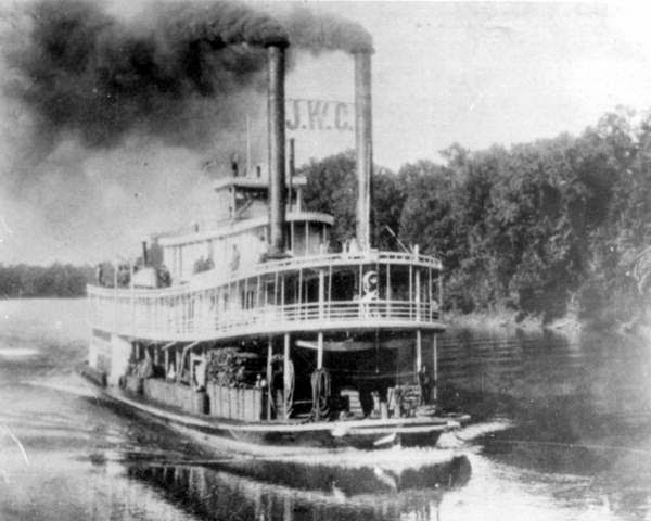
Cristoff's Ferry on the Chipola River
The ferry was in use by 1825.
Although the records are silent as to the reason her home was selected as a location for the meeting of the county court, it probably was picked due to its convenient location near the road leading from Cristoff's Ferry on the Chipola River. Centrally located in the area of the county where settlers were establishing themselves, it was a reasonable place for a meeting.

Convening at Mrs. Hull's house on April 18, 1825, were Jacob Robinson, William S. Pope and Joseph Russ. They appointed three commissioners - Dr. William P. Hort, James Patterson and Owen Williams - to find a permanent place for building a courthouse and county seat.

The commissioners viewed several locations before settling on the West 1/2 of the Southwest 1/4 of Section 4 in Township 4 North, Range 10 West. This is the present site of Marianna. 

Marianna later grew on the proposed site of the Town of Chipola
The County Court returned to Mrs. Hull's on June 10, 1825, to receive the recommendation of the commissioners and the members seemed to have been pleased, noting in their minutes that the future site of Marianna was "the most Eligible site for the public buildings of said County."

Things seemed to be going well and, from the temporary county seat at Mrs. Hull's, the County Court moved forward with plans for a town where Marianna would later stand. On July 11, 1825, the court members met at Widow Hull's and ordered Deputy Clerk Court/County Surveyor John B. Jackson to lay out the "Town of Chipola" on the designated site. A plat was prepared and a sale of lots was set for October 19.

The plan began to fall apart shortly before the date of the sale. The three members of the County Court met again at Mrs. Hull's place on October 17, 1825, just two days before the planned sale. Some controversy developed and two of the judges - Jacob Robinson and Joseph Russ - reconvened the next day and declared the selection of the site for a permanent county seat to be illegal.  The reason why they believed it to be so was never explained.

Site of Webbville
Instead, from their meeting at the Widow Hull's, the two judges ordered the permanent county seat to be established on a different site in Section 22, Township 5 North, Range 11 West. This site is about two miles southeast of the intersection of today's State Highway 73 and U.S. 231 north of Cottondale. 

The new location for a permanent county seat was immediately southeast of Section 16 of Township 5 North, Range 11 West, where the town of Webbville would soon grow. 

The selection of this site led to all out political war in Jackson County. Multiple elections would follow, as would decisions from both the Territorial Legislature and the U.S. Congress. In the end, the city of Marianna (founded in 1827) would emerge as the winner in the battle for county seat.

Although it would take years of political fighting to decide the location of a permanent county seat, the Widow Hull's Place holds the distinction of being Jackson County's first county seat by virtue of the fact that the county court met there repeatedly over an extended period of time. Mrs. Hull was not still in Jackson County by the time the county seat battle was decided. She relocated to Quincy prior to 1830.

Widow Hull's Place, the long forgotten first county seat, is #78 on our list of 100 Great Things about Jackson County, Florida.

Thursday, April 24, 2014

#79 Harry James (100 Great Things about Jackson County, Florida)

Trumpet virtuoso Harry James is #79 on our list of 100 Great Things about Jackson County, Florida.


Harry James performs "Concerto for Trumpet" in 1942.

Born in Albany, Georgia, on March 15, 1916, Harry Haag James has rightfully been called "swing's greatest trumpeter" and a jazz icon.

He was the son of Everette Robert James and Maybelle Stewart Clark James. Mr. James was the bandleader and trumpet player for the Mighty Haag Circus, in which his mother performed as an acrobat, aerialist and horseback rider.

If the name of the Mighty Haag Circus sounds familiar, that's probably because it wintered in Marianna for a significant part of its history. From here it traveled out by rail, truck and even horse-drawn wagon on tours that focused largely on the South. Despite its regional emphasis, however, the Mighty Haag was one of the most successful traveling circuses in American history. The James family, which lived in Marianna for a time, was one of the reasons for that success.

Born into a circus family, Harry first performed with the Mighty Haag Circus as a contortionist when he was only 4 years old. When he was 6, he was nearly trampled by his mother's horse during a performance with her, but was saved by performers. At about the same age, he began playing a snare drum with the circus orchestra and by the time he was 10 he started performing on the trumpet after receiving instructions from his father.

The James family relocated to Beaumont, Texas, in 1931 to perform with the Christy Brothers Circus. Harry attended school there during the winter months and won a Texas state music competition while attending Beaumont High School.

He never finished school, quitting to play trumpet professionally. He landed his first job with a national group in 1935 when he was hired by Ben Pollack's Orchestra. The next year he was hired by the famed Benny Goodman.

James quickly became a national sensation and in January 1939, with financial backing from Benny Goodman, he unveiled his own big band at a performance in Philadelphia, Pennsylvania. The featured vocalist was a then unknown male singer named Frank Sinatra.

Harry James and His Music Makers (known today as the Harry James Orchestra) broke into the Top 10 with "You Made Me Love You" during the week of December 7, 1941, the same week as the Japanese bombing of Pearl Harbor.

He performed in numerous movies and his music has appeared in even more, among them "My Dog Skip" and "Hannah and Her Sister."

James was married three times. His first wife was singer Louise Tobin, with whom he had two children. They divorced in 1943 and he married actress Betty Grable that same year. With her he had two more children, both daughters. James and Grable divorced after 22 years of marriage in 1965. He married a third time to Vegas showgirl Joan Boyd in 1968, but the marriage lasted only 2 years.

Despite a 1983 diagnosis of lymphatic cancer, Harry James continued to perform until nine days before his death. He passed away on July 5, 1983, exactly 40 years to the day after he married Betty Grable. The eulogy at his funeral was given by Frank Sinatra. In a strange bit of trivia, Betty Grable was buried 30 years to the day after the death of Harry James and 70 years to the day after their wedding.


Monday, April 21, 2014

#80 The Old Spanish Trail (100 Great Things about Jackson County, Florida)

1823 map showing part of original Old Spanish Trail
Road from Mt Vernon Ferry (Chattahoochee) to near Marianna is the original.
The historic Old Spanish Trail - sometimes called El Camino Real or the Mission Road - is #80 on our list of 100 Great Things about Jackson County, Florida.

Please click here to see the full list as it is unveiled.

Jackson County is blessed with a series of roads that could rightfully be called "Old Spanish Trails." There is the old Pensacola-St. Augustine Road, which followed the approximate route of today's State Highway 2. Early maps also show a road running up the west side of the Apalachicola and Chattahoochee Rivers along the route of today's River Road (Highway 271). And, of course, today's U.S. 90 is often called the Old Spanish Trail. There also is a county road connecting Sneads, Grand Ridge, Cypress and Marianna named the Old Spanish Trail.

So which of these was the original or "real" Old Spanish Trail?  The answer might surprise you because it is "none of the above."

Apalachicola River at Chattahoochee Landing
The Old Spanish Trail crossed the river here south of the bridge.
River Road and the Pensacola-St. Augustine Road were both Spanish trails, but the former went north and south while the latter replaced the earlier "Old Spanish Trail" of legend. U.S. 90 was built in the early 20th century and commemorates the original Old Spanish Trail but for the most part does not follow its route. Local records. meanwhile, show that county road called "Old Spanish Trail" was built during the Reconstruction era along the telegraph line that connected Marianna with Chattahoochee and Tallahassee. Its name commemorates the earlier Spanish road, but it does not follow the same route.

Where the Old Spanish Trail crossed the Apalachicola
The "real" Old Spanish Trail can still be traced today, although much of the route cannot be followed by car.

According to the accounts of early Spanish missionaries, soldiers and explorers, they crossed the Apalachicola River between today's Chattahoochee and Sneads by dugout canoe. Their route came down a natural gully cut into the steep bluffs to today's Chattahoochee Landing Park. From there they paddled across to the Jackson County shore at a point just south of today's U.S. 90 Bridge.

The original trail led west through the vast floodplain swamps along a still visible trace below Victory Bridge to the high bluffs south of today's Apalachee Correctional Institution. From the point it intersected with high ground, it turned almost due north and followed the ridge up across U.S. 90 to today's West Bank Overlook Park at the western end of the Jim Woodruff Dam.

Lake Seminole from the site of Mission San Carlos
The Spanish mission of San Carlos (the second of that name) stood on the hilltop here in 1680-1696. At the time of its existence it was the westernmost outpost of the King of Spain in all of Florida. Consisting of a church, a home for its priest and a large village of Catholic Chacato Indians, Mission San Carlos was destroyed by Creek Indian raiders in 1696.

Mission San Carlos is now a stop on the new Jackson County Spanish Heritage Trail, a 150 mile driving tour that links eleven Spanish colonial sites. A guidebook is available at the historic Russ House and Visitor Center in Marianna and an informational kiosk will be erected soon at West Bank Overlook Park.

Section of original Old Spanish Trail along Reddoch Road
From Mission San Carlos, the trail wound west across the site of present-day Sneads. It ran slightly north of but parallel to U.S. 90 until it reached what is now Providence Church Road. This modern county road follows the route of the "real" Old Spanish Trail northwest to the point where it intersects with State Highway 69 north of Grand Ridge.

From that intersection, the route of the original trail is followed by Reddoch Road (Highway 164-A), a paved county road that leads northwest from Highway 69 to its intersection with Blue Springs Road (Highway 164).

Providence Church Road and Reddoch Road combine to form the single longest stretch of the original Old Spanish Trail that can be driven by car in Jackson County today. The route leads through the beautiful rolling hills north of Grand Ridge and past numerous ponds and small lakes, some of which were described by Spanish explorers.

Old Spanish Trail kiosk at Blue Springs
The trace of the original road is in the background.
Although Reddoch Road intersects with Blue Springs Road today, the original trail continued straight west into Blue Springs Recreational Area where a portion of it can still be seen today.

On the left just past the booth where visitors to the park pay their entrance fees an old road can be seen deeply cut into the hillside overlooking the spring. This is a rare surviving segment of the actual Old Spanish Trail and is now Tour Stop #2 on the Jackson County Spanish Heritage Trail. A new interpretive kiosk is in place there.

Tour Stop #1 on the driving tour is Blue Springs and another new kiosk has been built overlooking the historic spring.

The Spanish knew Blue Springs by the name "Calistoble." The name is probably a Chacato (not to be confused with Choctaw) Indian word, but its meaning has been lost. They believed the spring to be the main source of the Chipola River, which they labeled as the "Calistoble" on early maps.

Andrew Jackson marker at the Natural Bridge of the Chipola
Florida Caverns State Park
From Blue Springs the trail angled again to the northwest to today's Florida Caverns State Park where it crossed the Chipola River by way of its Natural Bridge. A portion of the road to Blue Hole Spring follows the original route across the Natural Bridge.

The Spanish referred to the vast floodplain swamp of the Chipola River as the "great forest of Chipola." Tradition that the name comes from the Choctaw word for "sweet water" is not correct, as the Indians who lived in the area during the 1600s were Chacato and not Choctaw. Most of the Chacato later merged with the Alabama-Coushatta people who then lived among the Upper Creeks.

The main group of this band now lives in Texas, although some descendants reside in Oklahoma. The exact meaning of the word in their language is not known.

Blue Hole Spring at Florida Caverns State Park
From the Natural Bridge, the Old Spanish Trail followed today's park road to Blue Hole Spring. From there it continued west along a route that can no longer be driven but can still be seen in places.

The original trail passed a large cave several miles northwest of Marianna where the Spanish mission of San Nicolas de Tolentino stood in 1674-1675. This cave has not been identified by archaeologists and could be any one of several near today's intersection of Highway 73 and Union Road.

The Catholic church at San Nicolas was the site of the first Christmas service in what is now Jackson County. Established in 1674 at the Chacato village of Atanchia, the mission only survived for about one year. Spanish accounts indicate it stood at a cave large enough to hold 200 people and inside of which a natural spring or karst window produced a stream of water that flowed from the "living rock."

Jackson County Spanish Heritage Trail kiosk in Cottondale
From the long lost mission site, the trail angled to the southwest and crossed at or near what is now Cottondale before continuing on to pass out of the county west of Alford at today's Oak Hill.

A military expedition followed this section of the Old Spanish Trail in 1677 on its way to attack a fort held by Chisca (Yuchi) Indians somewhere in present-day Walton County. The history of that raid is interpreted by Tour Stop #11 on the Jackson County Spanish Heritage Trail. A new informational kiosk for the stop stands next to U.S. 231 in the parking lot of Cottondale City Hall.

An important part of American history, the Old Spanish Trail is commemorated by U.S. 90 today. Its real path is an important part of the new Jackson County Spanish Heritage Trail. You can learn more about that driving tour at http://visitjacksoncountyfla.com/heritage/spanish-heritage-trail.

Be sure to pick up a free guide booklet at the historic Russ House in Marianna and enjoy doing some exploring of your own!


Friday, April 18, 2014

#81 Legend of the Dogwood (100 Great Things about Jackson County, Florida)

Dogwood blossoms on Good Friday
My favorite local Easter legend is #81 on the list of 100 Great Things about Jackson County, Florida.

Please click here to see the entire list as it is unveiled.

The beautiful dogwood tree is one of the best things about spring in the Deep South. The little trees shed their leaves in the winter after offering a beautiful burst of fall red color, but then in the spring they bloom with an incomparable glory of white blossoms.

Popular tradition in Jackson County associates them with the crucifixion and resurrection of Jesus Christ.

According to the story, the dogwood once grew much larger and served a terrible purpose. Its wood provided the cross on which Jesus was crucified.
A wild dogwood in bloom.

As Christians know, the story of the crucifixion is one of both great horror and great redemption. Good Friday, which is being observed across the world today, is remembered as the day on which Christ was nailed to a cross outside the walls of Jerusalem. It is remembered with horror because of the great suffering and cruelty he suffered. It is remembered as a day of great redemption, because it was the day on which he took the sins of the world upon his own shoulders and gave his life that we might live.

As Jesus said, "Greater love hath no man than this, that a man lay down his life for his friends." By laying down his life for us on Good Friday, he offered us all a better world and a brighter future.

The Legend of the Dogwood holds that because the tree served a terrible yet necessary purpose in providing the cross on which Jesus sacrificed his life for all people, it was altered and yet saved by God. Its size was reduced so that no dogwood would ever again grow large enough  to be used in a crucifixion. Then, to make up for its loss in stature, God blessed the tree with its beautiful blossoms.
Dogwood tree in bloom.

The blooms of the dogwood come to life each spring just before Easter to remind us of the resurrection of Jesus Christ. To help in this annual rite of remembrance, the blossoms were given special features. They are formed of four petals, with each blossom taking the shape of a cross.

The center of the flower symbolizes the crown of thorns that was placed on Jesus' head and the tip of each petal is indented with the prints of the nails that penetrated his hands and feet. And finally, by Good Friday of each year red spots appear on the beautiful white blossoms to symbolize the drops of blood that spilled from the body of the Savior.

The legend is an old and treasured part of Southern culture and history and is #81 on our list of 100 Great Things about Jackson County, Florida.

Happy Easter!


Thursday, April 10, 2014

#82 The Pensacola-St. Augustine Road (100 Great Things about Jackson County, Florida)

A surviving section of the Pensacola-St. Augustine Road
The historic Pensacola-St. Augustine Road is #82 on our list of 100 Great Things about Jackson County, Florida.

Please click here to see the complete list as it is unveiled.

In 1778 the American Revolution was underway and its outcome was far from certain. While most Americans of today have heard of the 13 Colonies and their fight for independence from Great Britain, few realize that there were other colonies in North America that did not join the war against King George III.

1776 map shows East and West Florida
East and West Florida were both British colonies when the Revolutionary War began and both remained loyal to King and Country throughout the conflict. Founded by the Spanish, the Florida colonies had passed to the control of Great Britain at the end of the French & Indian (or Seven Years) War in 1763.

The British administered Florida as two colonies. East Florida extended from the Atlantic Ocean to the Apalachicola and Chattahoochee Rivers, while West Florida extended from the Apalachicola and Chattahoochee all the way to the Mississippi. What is now Jackson County formed the northeastern corner of British West Florida.

Purcell-Stuart Map of 1778, showing the Pensacola-St. Augustine Road
The only two cities in all of present-day Florida were Pensacola and St. Augustine. To link them, the British connected a series of Indian trails and parts of the Old Spanish Trail to form a new road that they called the Pensacola-St. Augustine Road. This early "super highway" was the predecessor of today's U.S. 90 and I-10.

Heritage Village in Graceville
A stop on the Jackson County Spanish Heritage Trail
In Jackson County, the route of the Pensacola-St. Augustine road is roughly followed by today's State Highway 2. It crossed Holmes Creek into the county where Graceville stands today and crossed through the modern sites of Campbellton and Malone before reaching the Chattahoochee River at Neal's Landing, where the Creek Indian town of Ekanachatte ("Red Ground") stood at the time.

The road was mapped in 1778 when a British force marched across Florida from Pensacola to reinforce St. Augustine against an expected attack by American Patriots. Accompanying that expedition was cartographer Joseph Purcell and his map of the Pensacola-St. Augustine Road provides a fascinating look back through time.

In western Jackson County, using Purcell's map as a guide, it appears that the historic road generally followed modern State Highway 2 east from Graceville to Campbellton. What is now Holmes Creek was shown on the map as the "Weekaywee Hatchee." This Hitchiti Creek term means "Spring Creek" or "Spring River." If the name looks familiar, there is a reason. Today's term Weeki Wachi (as in Weeki Wachi Springs) is a corruption of the Creek term Weekaywee Hatchee.

Coosa Old Fields (today's Campbellton)
As shown on the Purcell-Stuart Map of 1778
The road between Holmes Creek and today's Campbellton was described by Purcell as "small and little trod." Where Campbellton stands today, the map shows that in 1778 was a place called the Coosa Old Fields.

These "old fields" had been the site of the Spanish conversion or part-time church of San Antonio. The Chacato inhabitants who lived there had fled the area in 1675 following a rebellion against the Spanish missionaries. Most of them wound up living on the Coosa River in Alabama. Living on the Coosa Old Fields when Purcell passed through was a small band of Creeks who had a village on the site of present-day Campbellton that they called Puckanawhitla ("Peach Tree").

Forks of the Creeks swamp
From Campbellton the road followed the approximate route of today's State Highway 2 east, but as it neared Marshal Creek it veered to the southeast. Today's St. Phillips Road is an actual part of the original Pensacola-St. Augustine Road.

The route by which the road crossed the Forks of the Creeks swamps is no longer in use today, but Purcell noted crossing what he called the "Chanpooly" (today's Chipola River). The creek that he called the "Chanpooly" was today's Cowarts Creek, a main tributary of the Chipola.

Trace of Pensacola-St. Augustine Road
Notice State Highway 2 through the trees at left.
From the Forks of the Creeks to the Chattahoochee River, the old road roughly followed the route of today's State Highway 2. A section of the original can be seen running along the north side of the modern highway in the vicinity of its intersection with Pleasant Ridge Road.

The road passed through the modern town of Malone and continued on to the Chattahoochee River. The section of Biscayne Road between Concord Road and the point where Biscayne intersects with State Highway 2 is a part of the original Pensacola-St. Augustine Road that is still in use today.

Chattahoochee River at Neal's Landing Park
The historic roadway reached the Chattahoochee River at today's Neal's Landing Park. There in 1778 stood the large Creek village of Ekanachatte and the trading post of its chief, an individual called "The Bully" for his prowess as a businessman. It is a little known fact that British troops camped at what is now Neal's Landing during the American Revolution.

The Pensacola-St. Augustine Road was replaced in the 1820s by the Old Federal Road and still later by U.S. Highway 90 and eventually Interstate 10, all of which followed more direct routes between Pensacola and St. Augustine. Its surviving portions, however, remain important historical landmarks in Jackson County that date from before the time of the American Revolution.

Jackson County Spanish Heritage Trail (in red)
Click to Enlarge
Today's Jackson County Spanish Heritage Trail commemorates in part the historic roadway. A 150-mile driving tour that connects eleven important historic sites from the Spanish era, part of its route follows State Highway 2 from Neal's Landing Park to Graceville.

An interpretive kiosk has been erected in Malone to tell the story of the Pensacola-St. Augustine Road. It stands in the city park facing Highway 71, one-half block south of Highway 2. Malone is a great place to stop for lunch while driving the Jackson County Spanish Heritage Trail.

If you are interested in learning more about the new Jackson County Spanish Heritage Trail, guide books are available for free at the historic Russ House and Visitor Center on West Lafayette Street in Marianna. You can also learn more by visiting the Spanish Heritage Trail section of the TDC website at:  http://visitjacksoncountyfla.com/heritage/spanish-heritage-trail.


Monday, April 7, 2014

#83 The Gopher Tortoise (100 Great Things about Jackson County, Florida)

Gopher Tortoise
The fascinating and stately gopher tortoise is #83 on our list of 100 Great Things about Jackson County, Florida.

Please click here to see the full list as it is unveiled.

Gopher tortoises (Gopherus polyphemus) - or "gophers" as they are called locally - favor dry sandy lands and the piney woods of Jackson County are among their favorite habitats. My dad always said you could tell a Yankee from a Native Floridian by their definition of the word "gopher." A Yankee, he noted, thought that gophers had fur and were mammals. Native Floridians knew, of course, that gophers were tortoises!

A gopher tortoise out for a stroll.
Gophers are tortoises, not turtles. Both are reptiles, but turtles live in the water and tortoises live on dry land.

They live in burrows in the ground, some of which can be impressive in size. I've never been to the bottom of a gopher tortoise burrow, but the Florida Fish and Wildlife Conservation Commission indicates they average around 7 feet deep and 15 feet long, although burrows as long as 40 feet have been found.

A gopher tortoise heads for its burrow.
You can tell if a gopher tortoise is living in a burrow by looking at the shape of the opening. If the burrow entrance is half-moon in shape, the odds are that a gopher tortoise still lives there. If the burrow entrance is round, that usually means that the tortoise has moved on and an armadillo has taken up residence.

Be aware that abandoned gopher tortoise burrows are favorite homes for rattlesnakes.

During the War Between the States (or Civil War), soldiers from the Florida Panhandle were called "Gophers" because they liked to eat gopher tortoises so much. Private Wade H. Richardson of the 1st Florida U.S. Cavalry noted that the term was "derisive."

In fact, gopher tortoises were hunted almost to extinction during the late 1800s and early 1900s. Once considered a delicacy, they were shipped out commercially to restaurants all over the country aboard steamboats from ports including Old Parramore in Jackson County and Vernon in Washington County. Vernon, in fact, was once believed to be the largest gopher shipping point in the world. They remained important commercially until the dwindling population forced restaurants to switch to sea turtles for their soups and stews.

Headed underground in a cloud of dust!
The tortoises were favorites of sailors and sea captains during the 1700s and 1800s because they could be kept alive in the holds of ships and pulled out whenever the cook needed fresh meat! They remained popular for this use until refrigeration became commonplace on ocean-going vessels.

When the Great Depression swept across Florida in 1929, gopher tortoises became to residents of rural Jackson County what possums were to the residents of Wausau in Washington County. Nicknamed "Hoover Chickens" after President Herbert Hoover, they provided meat for hungry families.

A threatened species today, gopher tortoises still live in all 67 of Florida's counties. They usually graze within 150 feet of their burrows, which are common in pastures and pine woods. Controlled burns are vital to their survival, because they help assure that tender grasses and plants are available for them to eat. It is illegal to kill them or disturb their burrows.

Good places to see them include Three Rivers State Park, Florida Caverns State Park, the Upper Chipola WMA north of Marianna and Apalachee WMA north of Sneads.

If you would like to learn more about gopher tortoises, FWC has an excellent brochure available for download:  A Guide to Living with Gopher Tortoises.


Saturday, April 5, 2014

#84 The Pirate Billy Bowlegs in Jackson County (100 Great Things about Jackson County, Florida)


William Augustus Bowles
The pirate Billy Bowlegs is #84 on my list of 100 Great Things about Jackson County, Florida.

Please click here to see the entire list as it is unveiled.

Jackson County, of course, is inland from the Gulf of Mexico, yet it has the strongest connection of any place in Florida to the infamous pirate and adventurer William Augustus Bowles. He is the man celebrated in Fort Walton Beach today as the pirate Billy Bowlegs and is often confused with the Seminole chiefs of the same name.

How Bowles came to be called "Billy Bowlegs" is a mystery to me as there is no evidence he ever used the name during his lifetime. That point aside, however, he most definitely was a pirate.

Born in Maryland, he first came to what is now Jackson County during the American Revolution after he was thrown out of the British military. East and West Florida, divided by the Apalachicola and Chattahoochee Rivers, were then colonies of Great Britain. Spain's more than 250 year rule had ended in 1763 when it lost control of Florida in the treaty that ended the Seven Years' War (known in America as the French & Indian War).

Parramore Landing Park
Making his way east from Pensacola, Bowles likely was trying to walk home to Maryland when he became hopelessly lost in the vast wilderness of the Florida Panhandle. Rescued by Creek Indian warriors from the Perryman towns, he was brought to the Chattahoochee River.

The Perryman towns stood on opposite sides of the river near present-day Parramore Landing Park. Thomas Perryman, the half-Creek son of trader Theophilus Perryman, lived on the Georgia side of the river at what later became Fairchild State Park. His son, William, lived in what later became Jackson County at Tellmochesses, a Creek Indian town that stood on high ground back from the river just north of Parramore Landing.

Creek Indian village in Jackson County, Florida
Bowles became closely associated with both Thomas and William Perryman, both of whom had taken up arms along with their people on the side of the British in the American Revolution. By the time the future pirate reached their villages, they had fought against American Patriots in Georgia.

Bowles married into the Perryman family, becoming a son-in-law of Thomas Perryman and brother-in-law of William Perryman. He frequented their towns and was a regular fixture in the Creek Indian villages along the Chattahoochee and Apalachicola Rivers.

Flag flown by Bowles' pirate ships
In the years that followed, Bowles declared himself the "Director General" of the "State of Muskogee." In this capacity, he declared war on Spain and commissioned the "Muskogee Navy," really a flotilla of well-armed pirate ships that attacked merchant shipping in the Gulf of Mexico.

The Spanish Coast Guard sent armed ships to destroy Bowles and his nest of pirates, but the "Muskogee Navy" was too strong for them and proved victorious in a pitched battle at Apalachicola Bay. The Spanish retreated and the pirates continued their depredations.

Uniquely, the crews of the pirate vessels commissioned by William Augustus Bowles included not only white and African American sailors, but Creek and Seminole Indian sailors as well. While his "State of Muskogee" existed only on paper and in his mind, his ships sailed with diverse crews.

Bowles eventually was taken prisoner and died at El Morro Castle in Cuba. What became of his ships - except for one seized by the English in the Bahamas - is not known. His legend lives on at the Billy Bowlegs Festival in Fort Walton Beach and may soon be celebrated in a Pirate Festival being considered for Parramore Landing Park!

The little known fact that the Pirate "Billy Bowlegs" once lived in Jackson County is #84 on our list of 100 Great Things about Jackson County, Florida.

If you missed the earlier post about Bowles' lost pirate treasure, please visit Lost Treasure of the Money Pond.


Tuesday, April 1, 2014

Ghost Town of Old Parramore in Jackson County, Florida

Crumbling tobacco barn in Old Parramore
Old Parramore is an almost forgotten ghost town in eastern Jackson County, Florida.

Established in the years after the War Between the States (or Civil War), it was a major riverboat port that came into existence as the local economy shifted from cotton production to naval stores and timber. Paddlewheel boats like the John W. Callahan and W.C. Bradley provided transport for these commodities.

https://twoegg.blogspot.com/2015/01/52-did-titanic-curse-sink-john-w.html
The John W. Callahan often stopped at Old Parramore
Five different riverboat landings served the growing community, providing places where paddlewheel steamboats could edge up to the bank of the Chattahoochee River to load or unload passengers and cargo. The most important of these was Peri Landing (pronounced "pea-rye"). It was located on a bend of the river just north of today's Parramore Landing Park.

A warehouse landing, Peri had storage facilities where farmers and businessmen could leave bales of cotton, timber and other cargo for the riverboats to transport either upriver to Columbus, Georgia, or downriver to Apalachicola, Florida. It holds a unique although forgotten place in local history as the eastern end of a major county road built in 1914 to connect western Jackson County with the Chattahoochee River. The steel Bellamy Bridge over the Chipola River that so many people love and remember was built as part of an upgrade associated with the building of the new road to Peri Landing.

Annual Oak Grove Homecoming at Old Parramore
Back on the high ground away from the river, the town of Parramore grew. It was centered around today's intersection of Oak Grove and Parramore Roads and at its height included at least five stores, blacksmith shop, cotton gin, sawmill, gristmill, post office and more. Large naval stores operations grew around the town, with turpentine stills operating in almost every direction. Local senior citizens recall how they could look to the horizons and see the stacks of the stills streaming black smoke into the air.

Site of Old Parramore business district today.
Railroads and modern highways eventually put the paddlewheel riverboats out of business and Old Parramore vanished with them. One by one the stores, turpentine stills and other businesses faded away. All that is left today are a couple of historic houses, a one-room school, cemeteries and the ruins of Central School.

Making hush puppies at the annual Central School Reunion
Two annual events bring the vanished town back to life each October. The annual Oak Grove Homecoming has been taking place for more than 50 years and features music, historical discussions, a brief sermon and dinner on the grounds. Each year, dozens of current and former Parramore residents and their families attend, along with those who come to learn more about the historic community.

The other event is the Central School Reunion. Former students and their families gather each year at the ruins of the historic school to remember the days of their youth.

If you would like to learn more about this significant Jackson County ghost town, please consider my book:

Old Parramore: The History of a Florida Ghost Town [Book]

Old Parramore: The History of a Florida Ghost Town [Kindle]