A Two Egg TV Page. See more at https://twoeggtv.com.
Showing posts with label ocheesee. Show all posts

Wednesday, May 24, 2017

A mystery of murder & missing gold on the Ocheesee Road!

This rare 1849 $20 gold piece is at the National Museum of
American History. Could a treasure of similar coins worth
millions of dollars be hidden south of Grand Ridge, Florida?
National Numismatic Collection, National Museum of American History
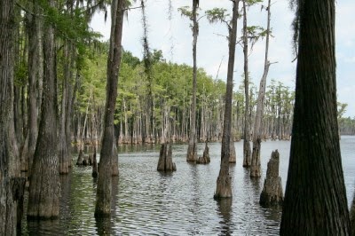
The end of the War Between the States (or Civil War) brought with it a time of hunger and starvation for people of all races in the rural counties of the Florida Panhandle. It was also a time when ruthless outlaws, many of them deserters from either the Union or Confederate army, stalked the roads and byways in search of plunder.

It was a time when anyone thought to possess gold or other valuables could quickly become the victim of a robbery or worse. 

A man named S.D. Thom learned this deadly lesson on the night of September 2-3, 1865, when he set off from Ocheesee Landing in Calhoun County to meet up with a man named Luke Lott:

Thom came ashore at Ocheesee Bluff in Calhoun County,
Florida. He traveled west from here to meet with Luke Lott.
From a private letter, written from Chattahoochee on the 6th, we learn that Mr. S.D. Thom, a well-known citizen of Columbus, was found dead, on Sunday, Sept. 3d, on the road between Luke Lott's house and Gregory's saw-mill, in Jackson county, Fla., about fifteen miles from Ocheesee, with nine buckshot in his body. He was buried on the 4th. - Columbus Daily Enquirer, September 19, 1865.

Thom, as the above excerpt notes, was a prominent businessman in Columbus, Georgia. He had gone down the Chattahoochee River from that city in a small boat and stayed with a friend named A.D. Bull on the night of August 26th:

...[H]e showed a bag which he said contained $800 in gold, and told his host that he was going to see Mr. Luke Lott, whom he knew, and whom he had promised a visit, if he ever came to Florida, to buy bacon. He left the next morning in a bateaux, a negro being with him, for Lott's place. - Columbus Daily Enquirer, September 19, 1865.

Calhoun County as it appeared in 1860
when it still extended all the way to the
Gulf of Mexico. Ocheesee is at the top left.
The mention that Thom had gone to Florida to "buy bacon" means that he was planning to purchase a large supply of pork. He was engaged in business in Columbus and the amount would have been considerable.

Luke Lott, said by the article to have been an acquaintance of the murdered man, was a fascinating - and deadly - character. 

He lived in northern Calhoun County between the Apalachicola and Chipola Rivers, but owned a large plantation that extended well into Jackson County. He had been successful and highly-regarded before and during the war, although there were also rumors that he had murdered one of his slaves. Lott was the captain of the Calhoun County Home Guard unit and military records indicate that he was a friend of Governor John Milton. 

He was a pro-secession "fire eater" - to use the terminology of the day - and became a bitter enemy of the "Carpetbaggers" (Northerners who moved South) and "Scalawags" (Southern political allies of the Carpetbaggers) who controlled Florida during the Reconstruction era. He was, in fact, later accused of becoming an armed assassin.

...The report is that he went to Lott's deposited his money with him, remained a day or two, and was last seen with Lott, going towards Marianna to buy bacon. Report further says that Thom had deposited some $8,000 and $4,000 with Lott, but the writer is confident that he had not exceeding $400. Some friend should examine into the affair. - Columbus Daily Enquirer, September 19, 1865.

The reports of the time do not mention the exact location where Thom's body was found other than to note it was on the road between Luke Lott's home, in Calhoun County, and Gregory's Mill, in Jackson County.

The beautiful old Gregory House at Torreya State Park was
the home of Jason Gregory, the builder of the mill mentioned
in the accounts of S.D. Thom's murder.
Gregory's Mill had been built in around 1850 by Jason Gregory, a well-known resident of Ocheesee, It stood on the headwaters of Carpenter Sink Creek about 1.5 miles west of State Road 69 and about the same distance north of the Calhoun County line. Gregory is primarily remembered today as the builder of the beautiful old Gregory House that once stood at Ocheesee but now can be toured at Torreya State Park.

Lott lived almost due south of the mill in northern Calhoun County, although he had extensive land holdings throughout the area.

Civil law had broken down in the region by the end of the War Between the States, largely due to the capture or killing of so many local authorities during the Battle of Marianna. The U.S. military responded to the reports of the murder and an investigation of sorts followed:

We learn that Mr. LUKE LOTT, a citizen of Calhoun county, well known here, is under arrest in this city charged with the murder of Mr. THOM, of Columbus, Ga. Since his arrest a negro has been taken into custody for the same offence under suspicious circumstances. The case will be tried before a Military Commission. Mr. D.P. Holland is council for the accused. The case of Mr. Lott, we understand, is one of mere suspicion only. - Tallahassee Semi-Weekly Floridian, October 25, 1865.

Jackson County as it appeared in 1888 (more or less!). The murder took
place south of Grand Ridge on the Calhoun County line.
D.P. Holland, who served as Lott's attorney during his trial before the military tribunal in Tallahassee, had been a lieutenant colonel and later a colonel in the Confederate service. His legal expertise proved worthwhile and Lott was acquitted of the charges against him. 

The fate of the African American man also charged with the crime is unknown. It is interesting to speculate whether he might have been the same man who accompanied S.D. Thom on his trip down the Chattahoochee River from Columbus, but this is not known with certainty.

The value of the stolen money is difficult to assess because so many different amounts were given by writers at the time. Gold was worth $30 per ounce in 1865 so a rough estimate, based on the range of values given for Thom's bag of coins, would be $16,738.05 to $503,400 at today's gold price of $1,258.50 per ounce.

This estimate is based strictly on the value of the gold itself and does not consider the value of 19th century gold coins to collectors! A single $20 Double Eagle gold piece from 1865 in excellent condition can be worth thousands of dollars today.

In other words, S.D. Thom's lost bag of gold could be worth millions. 

The money was not recovered at the time of his murder and may still be out there today, buried somewhere near the line that divides Jackson and Calhoun Counties.


Tuesday, May 2, 2017

How Ocheesee almost replaced Tallahassee as capital of Florida

The wooden frame capitol building in Tallahassee as it
appeared in 1831 when Ocheesee almost became state capital.
State Archives of Florida
Tallahassee had been capital of Florida for fewer than ten years when it almost lost the title to the Apalachicola River valley.

Pensacola and St. Augustine had never been thrilled that the new town being carved from the wilderness had taken their ancient titles as the twin capital cities of Florida. The population boom taking place in in Tallahassee, however, was rapidly solidifying its status.

The 1830 census revealed that Leon County, of which Tallahassee was the county seat, had become Florida's most populous county with 6,494 residents. Gadsden County was next with 4,895 while Jackson County was third with 3,907. 

Pensacola and St. Augustine had had lost their centuries old positions as the population centers of Florida in just nine years.

Florida as it appeared in 1832.
(Click to enlarge)
Anti-Tallahassee delegates to the Florida Territorial Legislative Council knew that 1831 might be their last chance to wrest the title of capital away from the growing town in the hills of Middle Florida. When the Council members convened that year, they took their best shot.

The delegates met at the tiny frame capitol building in Tallahassee in 1831 and voted for the appointment of a commission to review other potential sites for the establishment of a permanent capital city. 

The members of this commission began their work and three places quickly emerged as the leading candidates to replace Tallahassee. They were Ocheesee Bluff in Calhoun County, Mt. Vernon (Chattahoochee) in Gadsden County and an unidentified point on the Suwannee River. 

Mt. Vernon, which was soon renamed Chattahoochee due to mail confusion with the Alabama community of the same name, was the only one of these places that had become an actual town by 1831. It had been picked to become the site for Florida's new U.S. Arsenal and the arrival of steamboat traffic on the Apalachicola River spurred its growing development as an important river port.

The red clay of Ocheesee Bluff in Calhoun County, Florida.
Ocheesee Bluff, until recently the site of the Creek Indian village of Ocheesee Talofa, was also located on the Apalachicola River. The Federal Road crossed the river at Ocheesee, which was soon to be named the seat of government for short-lived Fayette County. 

Interests from the East Coast of Florida favored a location somewhere on the Suwannee River. A city there would have to be built from scratch, but unlike Tallahassee would be closer to St. Augustine, Jacksonville and Fernandina while also offering the advantage of river transportation.

It was a close decision:

SEAT OF GOVERNMENT. - The Commissioners appointed under the Resolution of the last Council have made separate reports - one infavor of Mount Vernon - two infavor of Ocheesee and one infavor of a point on the Suwanee as the seat of Government. - (Tallahassee Floridian, January 10, 1832).

This historic live oak tree at Ocheesee Bluff survives from
the days of the town of Ocheesee, Florida.
Three of the four commissioners favored a location on the Apalachicola River, but split between Mt. Vernon and Ocheesee. The latter place received a plurality of the total vote, but since the commission included four members it ended in a tie with Mt. Vernon and a site on the Suwanee.

Unable to break this deadlock, the Council delegates themselves decided to wait another year or two and see what might happen:

...The public buildings at Tallahassee will answer, until the progressive improvement of the Country shall show what point is likely to continue central, as regards the population of the Territory. - There are immense bodies of unexplored land of good quality in East Florida, and the Suwanee will probably be the center of population within ten years. - (Tallahassee Floridian, January 10, 1832).

The restored gunpowder magazine of the U.S. Arsenal at
Chattahoochee is now the Apalachicola Arsenal Museum.
It was not to be. The next ten years saw Leon County's dramatic growth continue while neighboring Jefferson County surged past Jackson to become the third most populous of Florida's counties. The St. Joseph Convention approved a proposed constitution for Florida and the territory was admitted to the Union as a state in 1845.

Ocheesee lost its chance to become capital of Florida by a single vote. Had the Apalachicola River supports on the commission unified their votes, the state capitol building would likely be there today. Instead, it is a ghost town. An old oak tree at Ocheesee Landing and the historic Gregory House across the river in Torreya State Park are virtually all that remain to prove it ever existed. 

Columbus, the town that soon grew on the Suwannee River, is also a ghost town today. Its cemetery and a few other traces can be seen at Suwannee River State Park.

Chattahoochee still survives as a small but charming city of just under 4,000 people. Its trail system has been named one of the finest of any small town in America and the Apalachicola River is both a Florida Blueway and a National Scenic Trail.

Tallahassee remains the state capital of Florida.

You can learn more about the ghost town of Ocheesee and Chattahoochee's historic River Landing Park in these videos from TwoEgg.TV:


Saturday, November 5, 2016

More new details from 1814 British map of Apalachicola & Chattahoochee Rivers

Section of Woodbine's
Map of 1814.
National Archives of Great Britain
(Click to Enlarge)
I first showed you part of the newly discovered Woodbine Map of 1814 in a post earlier this week. If you missed it, just click here to read that part before continuing with this article.

Today we are focusing on the next part of the map, which covers the Apalachicola River from the confluence of the Chattahoochee and Flint Rivers to the Gulf of Mexico. In the next post, we will look at the section that covers the Chattahoochee River north from the Alabama state line to above Eufaula.

The more than 200 year old Woodbine Map was discovered in the National Archives of Great Britain. It reveals a great deal of new information about the location of Native American settlements and refugee camps along the Apalachicola and Chattahoochee Rivers in the days immediately following the Creek War of 1813-1814.

Red Stick Creek refugees were pouring south into Spanish West Florida following the defeat of their last army at the Battle of Horseshoe Bend, Alabama. They were starving and fleeing for their lives. Not only were they being pursued by U.S. troops, but white-allied Creeks under William McIntosh and Choctaws under Pushmataha had joined the chase. Even William Weatherford, a former Red Stick fighter, was now guiding U.S. troops in pursuit of his former friends and allies.

 The Woodbine Map was drawn at a time when Red Stick families were establishing refugee camps along the Conecuh, Choctawhatchee, Chattahoochee, Apalachicola and other rivers of the region. So many of these refugees had died along the way that one old warrior told a British officer that he knew the trail to his enemy because it was marked by the graves of his children.

Capt. George Woodbine of the British Royal Marines arrived on the Apalachicola in May 1814. Ordered to recruit Creek and Seminole warriors to the cause of Great Britain in the ongoing War of 1812, Woodbine traveled as far upstream as Eufaula on the Chattahoochee River. His map appears to have been drawn during his journey and pinpoints the locations of both established towns and refugee camps.

It should be noted before continuing that the map was drawn at a time when large numbers of Native American men, women and children were still on the move. Many of the sites shown were transitory at best. Some were occupied for no more than a few weeks, which makes the document extremely valuable in understanding the movements of Red Stick groups as they entered Florida.

In our last article about the map, we discussed the massive number of towns and camps that had appeared along the relatively short section of the Chattahoochee River in Jackson County, Florida. Most Red Stick groups had not yet reached the Apalachicola River.

Looking at today's section of the map, we will move south down the Apalachicola from the forks of the Chattahoochee and Flint Rivers. The Tocktoethla towns of the Perryman family, shown just above the forks, were discussed in the last article.

The Apalachicola River as seen from River Landing Park in
Chattahoochee, Florida. Mosquito Creek enters from the left.
Moving downstream from the forks, the map shows Mosquito Creek flowing into the river from the east were the City of Chattahoochee stands today. The large island in the river below Chattahoochee is also shown.

The first Native American village below the confluence was the town of "Tomathleu" (also spelled "Tomatley" and "Tomathli") on the west bank in what is now Jackson County, Florida. This town had been established in the 1760s by a Creek band that moved down the river at the invitation of the British, who possessed Florida from 1763-1783.

Tomatley was one of the towns where the white trader James Burges had a home and operated a trading post. He also lived, had a family and operated a store on the bluff at today's Bainbridge, Georgia. Burges had died by 1814, but his children and grandchildren by his Tomatley wife still lived in the town.

The village was also the home of a man called Vaccapuchasse by the Spanish and the "Mulatto King" by the Americans. A maroon or escaped slave, he was the child of black and Native American parents and had become one of the principal chiefs of Tomatley. John Yellowhair was also an important leader in the town, which stood near the old Jackson County Port Authority complex.

Section of the Woodbine Map showing "Ocheesee Town" and
"Negro Settlements" in what is now Calhoun County, Florida.
The next village down the Apalachicola was Ocheesee Talofa, which stood on Ocheesee Bluff in what is now Calhoun County, Florida. This well-known town had also been established in the 1760s and was the one-time home of the white trader John Mealy. He had provided horses and other support to the British during the American Revolution. His son, Jack Mealy, was now the principal chief of Ocheesee.

Perhaps the biggest surprise from the Apalachicola River section of the newly discovered map is the large "Negro Settlements" that it shows running down the west side of the river below Ocheesee Bluff. This previously unknown settlement had been established by maroons (runaway slaves) who fled to the Apalachicola during and following the Creek War of 1813-1814. Some had been held by white plantation owners but others had been the slaves of Creek chiefs and principal men.

These individuals were now free and living in Spanish Florida. Woodbine undoubtedly spent considerable time with them as one of his assignments was to recruit a battalion of black soldiers for service in the British Colonial Marines. The maroon settlement below Ocheesee was not shown on later maps and its villagers probably moved downstream to Prospect Bluff at Woodbine's request. A number of the recruits who enlisted in the British service there gave their home town as "Ocheesee Talofa."

Prospect Bluff on the Apalachicola River.
The last Creek town shown on the river was Yawalla (Iola), the primary town of chief John Blunt. This village was at the site of today's Blountstown and not at Iola Landing lower down the river.

Blunt had fled with his people from the Creek Nation during the war and had suffered great losses in the process. White people sometimes called him Lafarka, but this must be a corruption of an Indian name or title as the Muscogee language includes neither the letter "r" nor its equivalent sound.

More Red Sticks would soon arrive on the Apalachicola as the bands of Prophet Josiah Francis, Homathlemico (Hoboithle Mico?) and others made their way east from the western Florida Panhandle. At the time of Woodbine's trip, however, these groups were still on the Choctawhatchee, Conecuh and other rivers to the west.

A noteworthy point of interest is Forbes Island just below Panton's Cliffs. This was not the Forbes Island today, but an upriver island formed by the confluence of the Apalachicola with the River Styx and other streams. It was also shown as Forbes Island on Spanish maps of this era.

Lower Apalachicola River as shown on the
Woodbine Map. Notice Prospect Bluff on the
east bank and the offshore anchorage of the
British warship HMS Orpheus.
Panton's Cliffs was Estiffanulga Bluff. It had been called Estiffanulga as late as 1804, but officers of John Forbes & Company renamed it in honor of William Panton. He had been a partner in Panton, Leslie & Company, the original name of the trading company. The name never stuck, however, and Estiffanulga remains in use today.

Further downstream can be seen the mouth of the Chipola River and Prospect Bluff. The bluff, called the Loma de Buena Vista by the Spanish, was the site of a Forbes & Company trading post and would soon be selected by the British as a location for one of two forts that they would build on the river.

Below Prospect Bluff, no settlements are shown as existing on the Apalachicola River. The map does show the anchorage of the HMS Orpheus off Cape St. George. The Orpheus was a British warship filled with arms and ammunition for the Creeks and Seminoles. She remained offshore while Woodbine made his trip up the Apalachicola and Chattahoochee Rivers. The war materials from the ship were being landed on St. Vincent Island where they were housed in temporary structures until they could be transported up to Prospect Bluff.

The next installment in this series will focus on the Chattahoochee River from the Alabama line north to Eufaula. If you would like to learn more about British activities on the Apalachicola and Chattahoochee Rivers during the War of 1812, please consider my books Nicolls' Outpost: A War of 1812 Fort at Chattahoochee, Florida and Milly Francis: The Life & Times of the Creek Pocahontas.

Both are available in either book or Amazon Kindle formats.


Monday, March 10, 2014

#94 The Wild Man of Ocheesee Pond (100 Great Things about Jackson County, Florida)

Who or what was the Wild Man?
The mysterious Ocheesee Pond Wild Man is #94 on our list of 100 Great Things about Jackson County, Florida. Click here to see previous items on the list.

If you aren't familiar with the story, the "Wild Man" was a mysterious creature captured at Ocheesee Pond south of Sneads and Grand Ridge in 1884. Some believe the incident may be one of the best documented cases ever of the capture of a Bigfoot or Sasquatch (often called the Skunk Ape in Florida).

The story of a strange hair-covered creature being captured in the swamps of Ocheesee Pond has long been part of the folklore of southeastern Jackson County, but while researching a different topic a few years ago I was surprised to find that the incident was documented at the time it took place.

Ocheesee Pond in Jackson County, Florida
The Wild Man had been causing trouble around Ocheesee Pond by making off with chickens, garden vegetables and other items from the farms that lined the borders of the vast swamp. Reconstruction had ended only eight years before and times were still hard for families in the area, so the men gathered together and decided to go after the creature. They cornered and captured him in the swamp.

Stories of the Wild Man's capture appeared in newspapers including The New York Times:
Steamboat Amos Hays at Chattahoochee in 1884.

News brought by the steamer Amos Hays from Lower River is to the effect that the wild man captured in Ocheecee Swamp, near Chattahoochee, and carried to Tallahassee, did not belong to a Florida asylum, and that all inquiry proved unavailing to identify him. He had been swimming in Ocheecee Lake, from island to island, and when taken was entirely destitute of clothing, emaciated, and covered with a phenomenal growth of hair. - The New York Times, August 1884.

The Amos Hays was a paddlewheel steamboat that carried passengers and commerce up and down the Apalachicola, Chattahoochee and Flint Rivers. It was at the Chattahoochee wharf when the Wild Man was brought up by the men who had captured him.

Administration Building at Florida State Hospital
Today's Florida State Hospital in Chattahoochee was then the State Asylum and it was thought by his captors that the raving creature was an escaped patient. He was not. In fact, he had not escaped from any mental institution in the country!

All that could ever be determined about him was that he was covered with hair, could not speak in any known language and had survived by "living on berries, &c."

The Wild Man was taken to Tallahassee where efforts to identify him continued through telegrams sent to state capitals throughout the nation. No information on his background could be found.  Baffled, state officials sent him back to the State Asylum in Chattahoochee.

Swamps of Ocheesee Pond
There, for now at least, he disappears from the record. The big question remains as to whether he was a man or something else. Perhaps somewhere deep in the records of the Florida State Hospital will be found the answer to that mystery. Was he just an unfortunate man suffering from a severe mental illness who had lived so long in the woods in a state of nakedness that he grew his "phenomenal growth of hair"? Was he an escaped ape, something that most of the people in Florida would have never seen at that time? Or was he a Bigfoot?

And then of course, there is the question of what finally happened to him?  If he was a man, did he recover enough to eventually go to his home? Or does the Wild Man rest in a grave in one of the State Hospital cemeteries in Chattahoochee? And if so, does that grave contain evidence that would answer the mystery of Bigfoot once and for all?

It is a true mystery and a fascinating part of Jackson County history and folklore.  To read more about the Ocheesee Pond Wild Man, please visit www.exploresouthernhistory.com/ocheeseewildman.