A Two Egg TV Page. See more at https://twoeggtv.com.
Showing posts with label houston county. Show all posts

Monday, September 9, 2019

Cottonwood, Alabama: "Floating on a pool of oil"

The Cottonwood Oil Boom of 1927

by Dale Cox


The 1927 oil boom is briefly mentioned on the historical marker
that tells the story of Cottonwood, Alabama.
One of the biggest oil booms ever seen in the South hit Cottonwood, Alabama, in October 1927. It started when someone realized that water from local wells would actually fuel gasoline engines:

     There are four wells on an acre of ground near the center of town at Cottonwood that have been showing evidences of oil for several years. All have been abandoned so far as drinking purposes, but recently evidences of oil became more pronounced.
     The oil is refined to a degree, having seeped from the underground strata of oil, which geologists say comes from the north, and which, they also say, cannot be far away.      
     Sam Barker, it is said, has been running a motor which operates a grist mill, the sole fuel used is that taken from his well. 
     Several automobile owners in Cottonwood have been propelling their cars with this fuel, it is said. - Dothan Eagle, May 4, 1927.

It didn't take long for the strange discovery to attract the attention of major investors. J.R. "Bob" Sealy and his brother were convinced of the validity of the strike when Bob filled a car with water from a local well and headed off for Dothan:

Bob Sealy, accompanied by Robert Malone, Calvin Welsh, John McCardle and John Bruner, drove a Ford touring car from Cottonwood to Dothan this morning on what they said was fuel drawn direct from one of the wells at Cottonwood which have been transformed by nature from drinking wells into refined gasoline. - Ibid.


The site of the O'Henry Oil Fields as it appears today in
Cottonwood, Alabama.
The Sealy brothers immediately purchased what quickly became known as the O'Henry Oil Fields, a large tract of land south of downtown Cottonwood. They eventually expanded their holdings to include thousands of acres and mineral rights were purchased for tens of thousands. The mineral rights acquisitions extended miles across the state line into Jackson County, Florida.

An oil geologist named R.G. Worthington was brought in from Oklahoma to inspect the site. He was reportedly a graduate of the Colorado School of Mines and visited Cottonwood in June 1927:

...He expressed his opinion that, beyond a doubt, the product coming into these wells is coming from crude oil. He made the statement that he had seen the same product coming out of the ground in other territories. Mr. Worthington has had eight years of field geology. Part of this time was spent with the Gypsy Oil Company of Tulsa, Oklahoma. His opinion is considered very valuable and correct. The opinion of many other geologists who have visited the O'Henry Oil Fields. - Dothan Eagle, June 17, 1927.

The opinion of Worthington was all it took. J.R. Sealy sent a petition to the Alabama Public Service Commission seeking permission to sell 750 acres of land. Each purchaser would gain one-acre of property and a "unit interest" in Sealy Well No. 1, the oil well that the Sealy brothers planned to drill.

This early Fire Protection Map shows many of the
buildings built during the Cottonwood oil boom.
Courtesy of Troy University.
At the same time, business interests in the community exploded. A committee of investors quickly committed to open a bank in Cottonwood:

The bank will be located next to the Cottonwood post office, on the site where the Rose Team room now stands. The tea room will be moved one lot south. This bank will be Spanish type, stucco building. The interior finish will be of Pecky Cypress, the same finish which has recently been used in the construction of the Cove Hotel at Panama City, Florida, and the dining room of the New Albany Hotel, Albany, Georgia. - Ibid.

Public excitement over Cottonwood oil reached its peak in late September and early October 1927. The Public Service Commission approved the planned land sale, and the town was deluged with people:

During the day Sunday, several thousand automobiles visited the Cottonwood section. In every instance, Bob said, these people were thoroughly sold on the merits of his proposition. They got out of their automobiles and looked into the wells, saw the oily film that covered them, smelled of the water drawn from them, and did every other thing that a curious throng is expected to do.
They were convinced, even as I was convinced last week, that something strange was happening in Cottonwood. In some instances they were ready to place bets that oil would be found. In others they admitted their ignorance even in the face of the things they saw but were filled with hope that oil would be found in commercial quantities. - Dothan Eagle, September 27, 1927.

A barbecue sponsored by the Sealy Brothers attracted 15,000 people to Cottonwood on October 6, 1927. They stood witness as the drill bit of Sealy Well No. 1 bit into the earth and started its way down. A second derrick - Sealy Well No. 2 - was already under construction by then. So high was the demand for information that Bob Sealy opened an office on North Foster Street in Dothan:

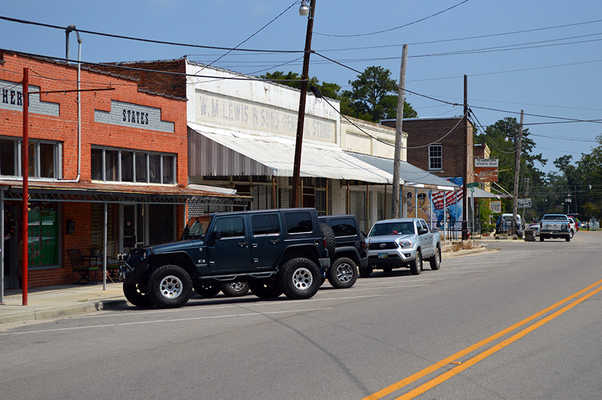
The oil boom led to a rush of commercial construction in
Cottonwood, as investors poured into the town.
As all this goes on, the people of Cottonwood continue with their program of building. Stories are being told of the opening of tea rooms, drug stores, warehouses, and various other forms of business...And while all this goes on, nine shallow wells in and around Cottonwood continue to flow a product so pure that it runs automobiles and gasoline engines. - Ibid.

By early October the Sealy brothers invested $40,000 of their own money in the belief that Cottonwood was about to become one of the wealthiest towns in America. In fact, Sealy Well No 1 did strike oil:

At 180 feet, Mr. Sealy said, salt water was struck. At 120 feet and also a depth slightly greater than 180 feet, fine oil showings were found. The oil showing shown at these two depths were similar to the oil in the nine surface wells in the Cottonwood community. - Dothan Eagle, December 13, 1927.

The well eventually reached a depth of nearly 5,000 feet, but the expected gusher never came. There was oil under Cottonwood, and it was from a natural deposit, not a leaky fuel tank as some like to claim today. The Sealy brothers just were never able to find it in a sufficient quantity to pump up for commercial purposes.

The oil boom faded as quickly as it had started and was over by the time the Great Depression hit two years later in 1929.

Despite its failure as an oil well, however, Sealy Well No. 1 did prove profitable. The water struck at 180 feet was not just salty, it was warm, and when the derrick was moved, it continued to flow up from the pipe in artesian style.

Dreams of oil wealth faded, but the story of Cottonwood's famed hot mineral well or "hot springs" was just beginning. More on the Sealy Hot Mineral Wells is coming in the next article!


Monday, November 14, 2016

Newly discovered map shows key Creek Indian villages on Chattahoochee (Part 3)

Portion of the Woodbine Map of 1814
showing the Chattahoochee River in
Southwest Georgia and Southeast Alabama.
National Archives of Great Britain
(Click the map to enlarge)
This is the third part in a series of four articles about the newly discovered Woodbine Map of 1814.

Located in the National Archives of Great Britain, the map is believed to have been drawn by Capt. George Woodbine of the British Royal Marines.

The captain was the advance officer for a planned landing of British Royal Marines in Spanish Florida. The War of 1812 was then underway and the British were coming to enlist maroons (runaway slaves) and Native American warriors forplanned attacks against Mobile, New Orleans and the southern United States.

The map is remarkably narrow and long so it has been necessary to break it into four parts for this series.  If you missed the two earlier articles, you can read them here before continuing with this post:

Part 1: Map reveals details of Jackson County's Native American population.
Part 2: New details from 1814 British map of Apalachicola & Chattahoochee Rivers.


In today's segment, we look at the section of the map that covers the lower Chattahoochee River in Alabama and Georgia.

Admiral Sir Alexander Inglis Cochrane
He sent Capt. Woodbine to the Apalachicola River
with orders to make contact with as many Creek
and Seminole groups as possible.
National Gallery of Scotland
Beginning at the bottom of the map, you will notice the Creek Indian village of "Red Ground" on the left or west bank of the Chattahoochee. This village stood at today's Neals Landing Park in what is now Jackson County, Florida. This is where State Road 2 crosses the river to connect Malone, Florida, with Donalsonville, Georgia.

The creek shown on the west side just above the village is Irwin's Mill Creek, which rises just across the state line in Houston County, Alabama, and then flows southeast through Chattahoochee State Park to cross the Florida border and empty into the river a short distance north of State Road 2.

Moving upriver you will next see the location of the ancient Lower Creek village of "Chiskee Tallofa" (Chiscatalofa or Chisca Town).

The Chisca were living in Northwest Florida when first encountered by the Spanish and the Purcell-Stuart Map of 1778 shows an area surrounding the town of Ekanachatte or "Red Ground" as the Chisca Old Fields, an indication that this had been their home-site at some point in the past.

Portion of the Purcell-Stuart Map of 1778 showing the
"Cheeske Old Field" adjacent to Ekanachatte.
National Archives of Great Britain
Some speculate that the Chisca were the ancestors of the better known Yuchi (or Euchee), but this remains an unproved theory. It is known that they were bitter enemies of the Spanish and joined with the neighboring Chacato to rebel against Franciscan missionaries in 1675. They successfully drove Spanish friars from their territory, but were defeated in a retaliatory attack. Some went to live in the area around Pensacola Bay while the main group of Chisca moved up into the Lower Creek towns, took part in the migration of that group to the Ocmulgee and Savannah Rivers. The Chisca joined with the rest of the Lower Creeks in migrating back to the Chattahoochee River in 1716-1718. From that point on Chiscatalofa was regarded as one of the principal towns of the Lower Creeks.

The town had been the scene of one of the councils that approved the massive Forbes Purchase of 1804. That agreement transferred 1.2 million acres of land from the Creek Nation to John Forbes & Company as payment for debts owed to the company. It included most of today's Apalachicola National Forest.

From "Chiskee Tallofa" continue to follow the river north. The creek shown entering from the west just above the town was Bryan's Creek in present-day Houston County, Alabama. A small settlement or village is marked by the circular symbol on the south side of the creek's mouth.

On the Georgia side of the river will next be seen the village of the "Conoloah Tribe." This town was located adjacent to a natural spring that flows into the Chattahoochee at a point just south of the border between today's Seminole and Early Counties.

The next town encountered as you continue to trace your way up the river is "Emassee Town" (Omussee Talofa). The name Omussee remains in use today in eastern Houston County, Alabama. Omussee Creek flows into the Chattahoochee river just south of Columbia, Alabama.

The Omussee of 1814, however, was located well-south of that point in the vicinity of today's Gordon, Alabama.

Like the Chisca, the Omussee were an ancient town. Their name is better known in the history of Florida and Georgia as Yamassee. These people were encountered by the Hernando de Soto expedition as it passed through Georgia and later allied themselves with the British and took part in slave-catching raids against the Apalachee and other groups in Florida.

The Yamassee joined with the Lower Creeks and other groups to rise up against the British in 1717 but were defeated. Most fled south to the St. Augustine area of Florida where they formed an alliance with the Spanish, but one group wound up living among the Lower Creeks on the Chattahoochee River. They remained there until they were forced west on the Trail of Tears in 1836.

Several unnamed small villages are shown on the river above "Emassee Town." Finally, the Cedar Creek shown flowing into the Chattahoochee from the west still bears that name today and is located just north of Gordon, Alabama.

I will post a final part of this series in the next few days to show and explore the uppermost part of the map which extends up the Chattahoochee River from Cedar Creek to Eufaula.  Watch for it!